Frequently Asked Questions
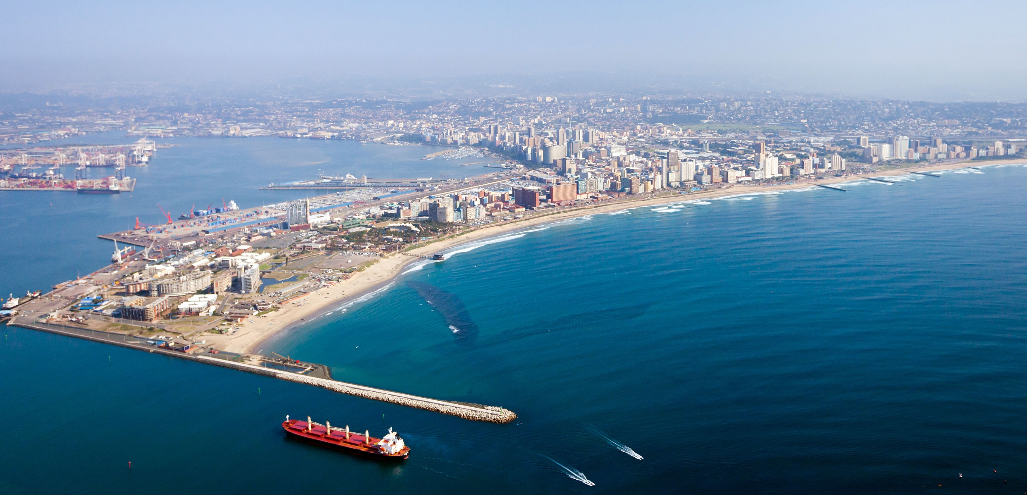
What is the name of the harbour in Durban?
The Port of Durban, commonly called Durban Harbour.
Where is Durban found?
The exact latitude and longitude of Durban are 29.8732° S, 31.0245° E
What is the time in Durban?
Local time is GMT/UTC + 2 hours
What is South African currency?
ZAR
What is the side of its entrance?
The entrance channel has been widened to 222m at its narrowest point. The entrance channel is now 19m deep in the outer entrance shallow to 16.5m draught in the inner channel.
How many berths Durban Port have?
The port has a total of 59 effective berths excluding those used by fishing vessels and ship repair.
Is pilotage compulsory?
Pilotage is compulsory for all vessels from a point three miles northeast of the port entrance, with a helicopter performing most pilot transfers, backed up by pilot boat service when the helicopter is unavailable.
Is navigation available?
Navigation is subject to VTS (vessels tracking service system) controlled from the Millennium Tower on the Bluff including all shipping movements inside port limits. Tug assistance is required. Draught within the port varies according to location.
What are the working hours of Durban Harbour?
The Port of Durban is open 24 hours a day, seven days a week, although cargo working may be restricted on official public holidays.
Is fresh water available 24 hours?
Fresh water is available ex pipeline at all berths and approximate pumping rate various between 25-35 MT per hour.
What are the activities that are permitted during daylight only?
♦ Fishing vessels presenting language & ore forward visibility problems.
♦ Double banking / de coupling
♦ No main engines – shifting
♦ Maydon wharf channel- vessels over 200m Loa
♦ Island view channel – vessels over 200 m Loa
♦ Towing –immoblized vessels
♦ Dormac & Elgin repair quays
♦ Explosives cargo / tankers
What are the restrictions in the port of Durban?
→ The entrance channel has a depth of 19m (62.3 feet) from Chart Datum, and a width of 222m (728.3 feet) between caissons.
→ Maximum length 350m
→ Maximum beam 46 m
→ Maximum draught 12. 6m / subject to allocated berth.
NB. The draft is governed by the depth at the appropriate berth.
→ Under keel clearance at berthing & sailing – 60 cm at all times.
→ Under keel clearance alongside berth at all states of the time 30 cm.
Ballast
Vessels must be adequately ballasted to permit safe navigation within the port. Only clean, locally loaded ballast water, may be discharged within the port.
Bunkering Information
Bunkering permitted in the port only and not at the anchorage & this applies to all South African coastal ports. The oil majors Shell, BP and Engen, and in Cape Town under contract to Chevron. Bunkers are supplied via barge, there are two bunker operators and amongst them there is 4 modern bunker barges that supply bunkers in the port with all capable of carrying approximately 4 250 tons of product (HFO / Gas Oil / Diesel) separately segregated. The pumping rates various as per the vessels required rate. The maximum pumping rate that the barge can achieve is 1000 MT per hour.
If you need any additional information we will be most glad to assist. Just drop us an email at:operations@portagent.co.za